To preserve the natural landscapes along the Qiantang River, I analyzed a 200-kilometer stretch of riverbank videos. By carefully examining the footage, I calculated the visual proportions of seven distinct elements present throughout the entire shoreline. Subsequently, I developed a visualization platform that identifies and maps these elements along the riverbank. This platform is a valuable tool in safeguarding the natural beauty and ecological integrity of the Qiantang River, enabling effective management and conservation efforts.
This work has been re-presented in Rez de Ville / Urban Ground Floors 2023.
# The Idea
This project aims to protect the historical and cultural features of the Qiantang River and the upstream Fuchun River and Xin’an River, covering a more than 200-kilometer waterfront. The famous Fuchun Mountain Habitat map depicts the natural scenery on both sides of the strait, but now it has been damaged by the excessive development of many residential buildings.
# Data Process
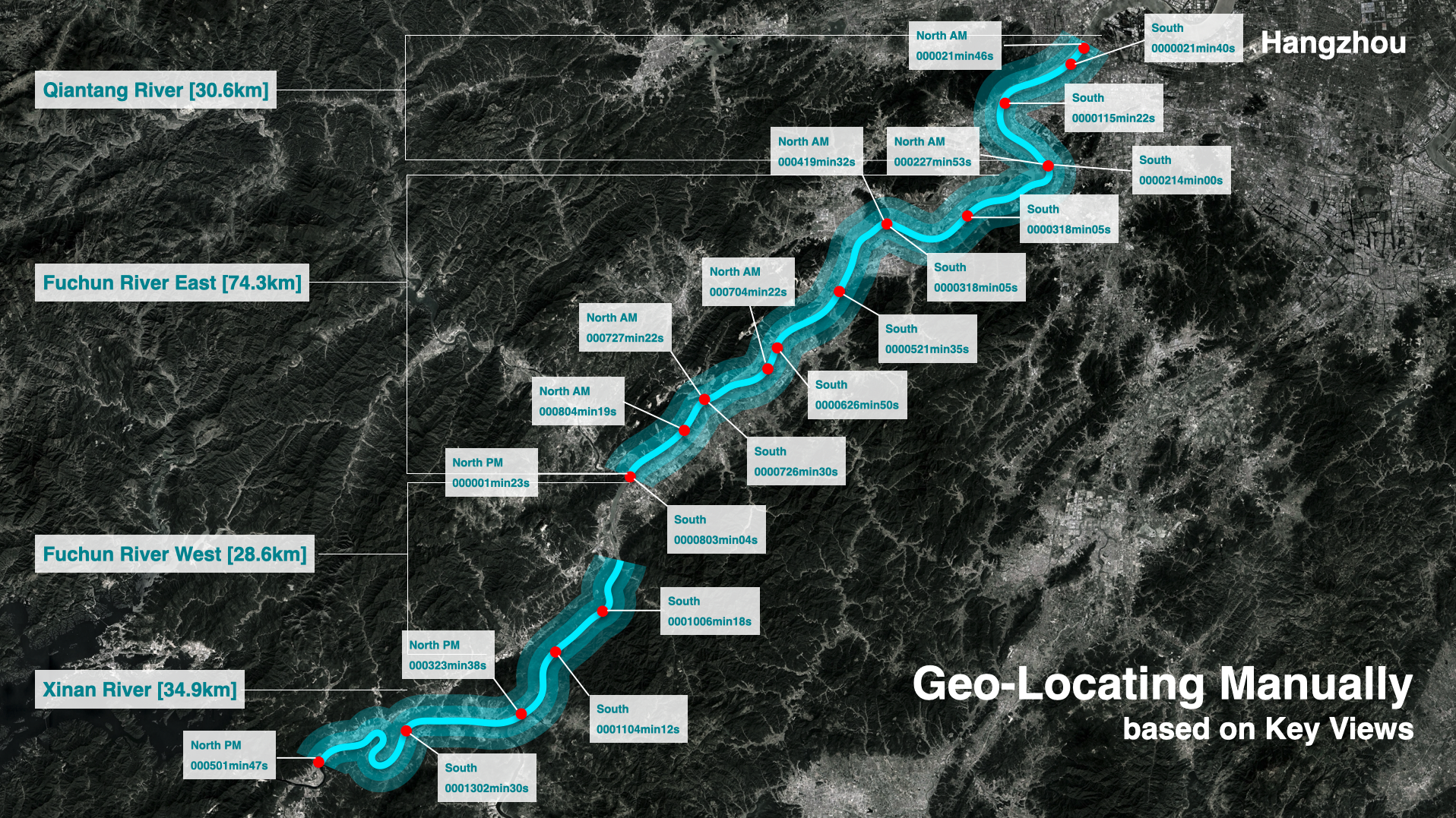
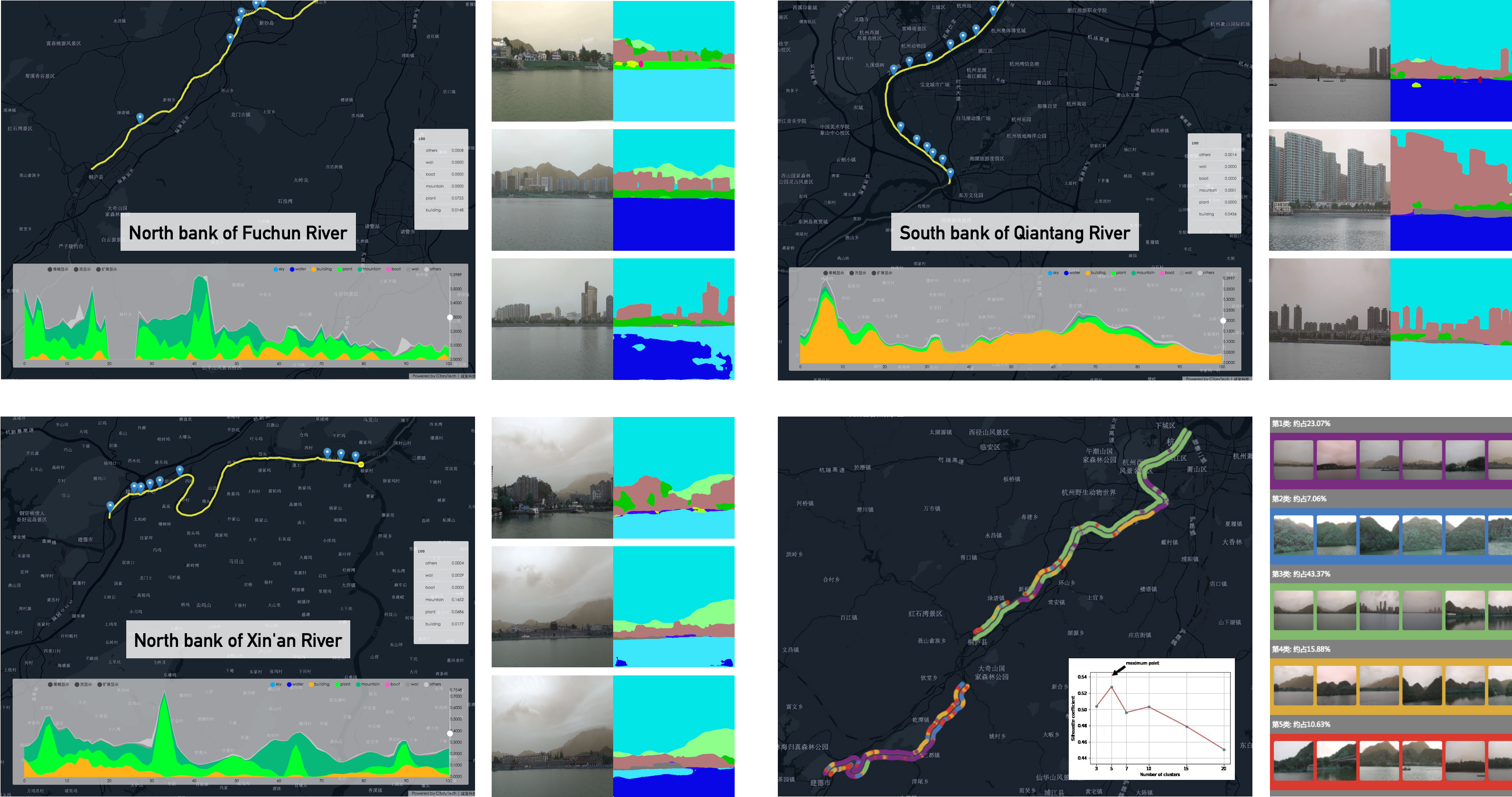
The project is conducted based on the video along the Qiantang River, where over 40000 frames are extracted along the three sections covering the north and south bank.
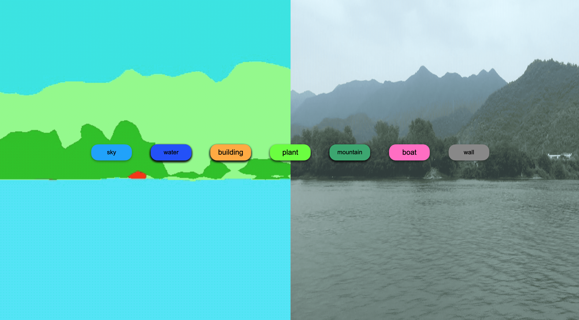
After segmenting the video frames into different segmentations, we could view different landscape prototypes along the river.
# Result Analysis
One of the major triggers for this project is to identify over-developed real estate. By composing metrics such as building height / plant height, it is easily to locate those banks.
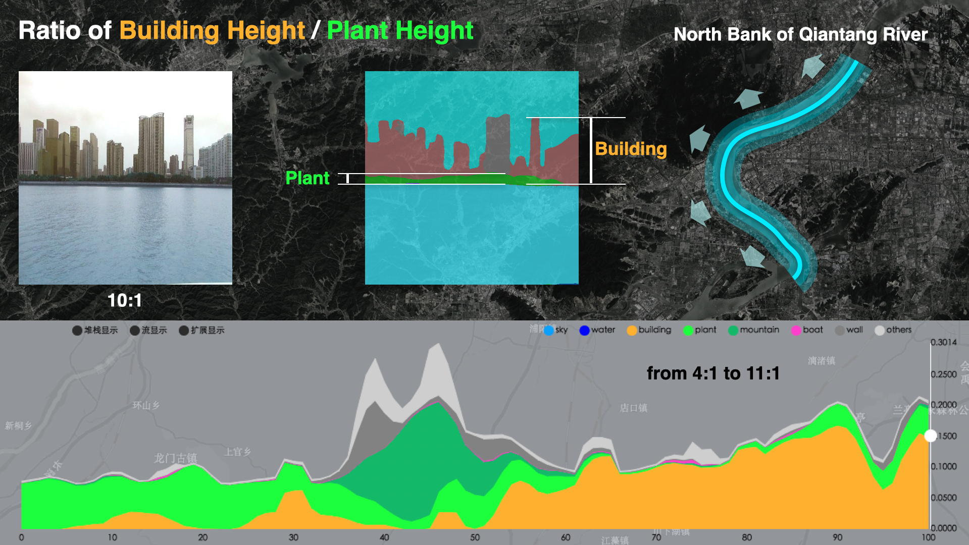
Other methods are also applied for each section of the entire river.
# Demo Video
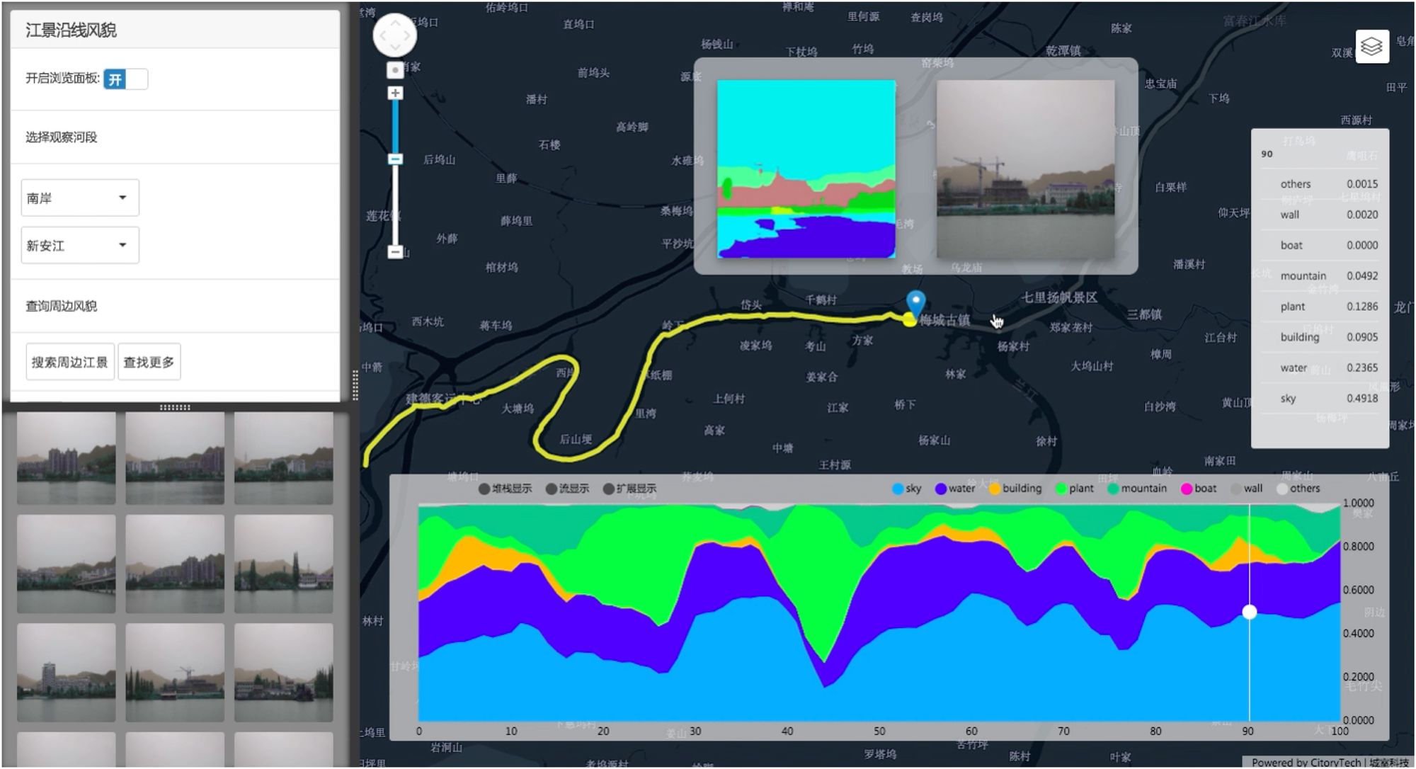
Below is a platform we created for verifying the metrics for different waterfront view sections.